
By meteorologist Lívia Caetano
Weather forecast – Wednesday (February 11th)
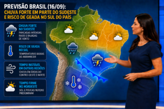
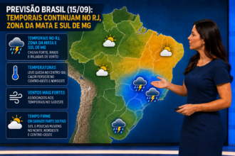
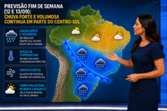
Wednesday will be marked by contrasting weather across Brazil. While the advance of a new cold front will bring moderate to heavy rain to the South, the presence of humidity, heat, and systems like the ITCZ will maintain instability in other regions. Check out the detailed forecast, organized by macro-regions.
Southern Region – (RS, SC, PR): cold front advancing with heavy rain and storms
The morning begins with more stable weather across most of the Southern Region, with sunshine prevailing and rising temperatures. In northern Paraná, there is a chance of light rain from early morning. Later in the morning, areas of instability associated with the advance of a new cold front will cause moderate to heavy rain in the southwest, west, south, and Campanha Gaúcha regions, with thunderstorms. Between late morning and early afternoon, humidity and maritime infiltration will favor light rain in northeastern and northern Paraná, southern Santa Catarina, and the Serra Gaúcha region. Throughout the day, showers will spread across much of Rio Grande do Sul, with a risk of storms in the southern strip, as well as the northeast, Serra, and southern coast of the state. In the interior of Santa Catarina and in areas of northern, southern, and southeastern Paraná, the rain will also be more intense, while in other areas the weather will remain stable. Heat will prevail, and wind gusts will vary between 40 and 50 km/h, possibly reaching 70 km/h in western Rio Grande do Sul.
Porto Alegre – RS: sunny morning with increasing showers in the afternoon. High of up to 37°C.
Curitiba – PR: chance of fog overnight, sun with clouds in the morning and rain in the afternoon. High of 31°C.
Southeast Region – (SP, RJ, MG, ES): Instability intensifies in the afternoon.
With the South Atlantic Convergence Zone (SACZ) disrupted, humidity continues to maintain instability in the north, northeast, northern coast, interior, and east of São Paulo, southern Rio de Janeiro, and much of Minas Gerais, with light to moderate rain and heavier rain in some areas, especially in Minas Gerais. The morning starts more stable in other areas. Between late morning and early afternoon, showers intensify in almost all of Minas Gerais and much of São Paulo, with a risk of storms in the northwest, west, and south of Minas Gerais, northern and northeastern São Paulo, and the Paraíba Valley. In Rio de Janeiro and southern Espírito Santo, the rain is more intense, with a risk of storms in the Serra and southern Rio de Janeiro state. Temperatures become more pleasant in much of the region, but the heat increases in western and southern São Paulo, Rio de Janeiro, northeastern Minas Gerais, and much of Espírito Santo. Wind gusts between 40 and 50 km/h affect São Paulo, the Triângulo Mineiro region, the Lakes Region (RJ), and the southern coast of Espírito Santo.
São Paulo – SP: Heavy rain has been falling since early morning in areas of the north, northeast, east, north coast, and Paraíba Valley. In the morning, instability persists in these regions, and there is also light rain in the interior and coastal areas. Throughout the day, the showers intensify, with a risk of storms in the north and northeast of São Paulo state and in the Paraíba Valley, while in the south of the state the rain is light. There is a chance of drizzle during the early morning hours, and temperatures may reach 28°C.
Rio de Janeiro – RJ: Sun with many clouds in the morning and moderate to heavy showers throughout the day. High of up to 33°C.
Belo Horizonte – MG: Rain from early morning, moderate to heavy, with a risk of thunderstorms. High of 27°C.
Central-West Region – (MT, MS, GO, DF): heat and showers with an isolated risk of thunderstorms
Even with the South Atlantic Convergence Zone (SACZ) disrupted, light to moderate rain is forecast in areas of Goiás and Mato Grosso from early morning, with moderate to heavy intensity across much of Mato Grosso. In Mato Grosso do Sul, the morning begins with more stable weather. Between late morning and early afternoon, heat and humidity favor increased showers in Mato Grosso and Goiás, with a risk of isolated thunderstorms in northwestern and southeastern Mato Grosso, as well as southern, northeastern, and eastern Goiás and the Federal District. In southwestern Mato Grosso, the rain will be weaker and more irregular, with sunny spells. In Mato Grosso do Sul, the heaviest showers will affect the eastern half of the state, while other areas will remain more stable. The weather will remain muggy, with high temperatures and wind gusts between 40 and 50 km/h in southern Mato Grosso and Goiás and in northern and eastern Mato Grosso do Sul.
Campo Grande – MS: Sunny with clouds in the morning and a chance of passing showers in the afternoon. High of 30°C.
Cuiabá – MT: Sunny with clouds, light rain in the morning and showers throughout the day and night. High of 29°C.
Northeast Region – (MA, PI, CE, RN, PB, PE, AL, SE, BA): heavy rain in the interior and coastal areas.
Rain showers are more intense in western and inland Bahia, the southern half of Piauí, and much of Maranhão, while the ITCZ (Intertropical Convergence Zone) influences the northern coast of the region. In the morning, conditions improve, but isolated showers still occur in these areas and along the eastern strip, where the rain may be heavier. In the afternoon, instability increases in Maranhão, Piauí, Ceará, western Bahia, northern Rio Grande do Norte, and western Pernambuco, with moderate to heavy rain and a risk of storms, especially in Maranhão, Piauí, and the coast of Rio Grande do Norte. Between the coastlines of Paraíba, Sergipe, and Alagoas, rain is moderate to heavy. In other areas, the weather remains stable and hot. Relative humidity is lower in northern and inland Bahia, potentially falling below 30%. Wind gusts between 40 and 50 km/h affect coastal areas and the eastern part of the region.
Northern Region – (AM, PA, TO, RO, AC, AP, RR): ITCZ maintains instabilities and storms
Heavy rain has been falling since the early hours of the day across much of Amazonas, Pará, Tocantins, Rondônia, and Amapá, under the influence of the Intertropical Convergence Zone (ITCZ). In other areas, the morning begins more stable. Throughout the day, cloud cover increases and instability intensifies in Amazonas, Pará, Amapá, Tocantins, Rondônia, and Acre, with moderate to heavy rain and a risk of storms in Rondônia, Tocantins, eastern Pará, western Acre and Amazonas, as well as southern Amazonas and the northern half of Amapá. In the far south of Roraima, there is a chance of showers, while the rest of the state remains more stable, with sunny spells, a muggy feeling, and lower humidity in northern Roraima.